
Main Stem 18
Telegraph Road to Potomac River
9 July, 2014, Canoed downstream from Telegraph Road to the mouth of Accotink Creek where it joins the Potomac River in Accotink Bay.
 Only the tidal portion of Accotink Creek readily lends itself to paddling, with most of the rest of its length featuring numerous shallow riffles that require frequent portages. This description applies here as well, from Telegraph Road as far as a few hundred yards downstream from the Poe Road bridge on Fort Belvoir.
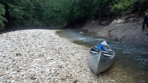
The float trip down this stretch of the creek begins with the thrill of negotiating the man-made Class II ledge at the bridge. This series of boulder barriers across the creek was likely intended to direct the current toward the center of the channel, away from the bridge supports. While there are satisfying stretches of water deep enough for paddling, very often we were portaging over shallow Class 1 riffles too numerous to count. Squeezing through narrow channels between, over, and under numerous fallen logs (a result of excess runoff from paved surfaces) was also a frequent necessity.
Several stream restoration projects are seen along this section, some less successful than others. There are also extensive areas of riprap stone reinforcement along the banks bordering Davison Airfield on Fort Belvoir.
Passing under Route 1, Accotink Creek enters the Accotink Bay Wildlife Refuge, a part of Fort Belvoir, but open to public use. Mason Run, a tributary, joins Accotink Creek from the north side slightly upstream from the Poe Road bridge.
Sailing into the tidal portion of Accotink Creek downstream from Poe Road we were aided by an outgoing tide down a channel with no further obstacles. Near its mouth, Accotink Creek flows through a broad marsh, where there are notable stands of Pickerelweed, Pontederia cordata, and Spatterdock, Nuphar advena, a cousin of water lilies.
Accotink Creek empties into Accotink Bay, on the Potomac. The bottom of the bay is surprisingly shallow. We walked across areas too shallow to paddle, although depth varies with the tides by a few feet. There are extensive beds of Hydrilla in the bay.
Notable animal sightings along the way: A dozen beavers, one green heron, two bald eagles, one or two ospreys, a Mississippi kite, a pair of wild turkeys roosting in the treetops, and numerous blue herons, especially in the wetlands at Accotink Bay. The shore of Accotink Bay is littered with the shells of invasive Asiatic clams and a few shells of the Easter Floater freshwater mussel, Pyganodon cataracta.
20 August & 30 August, 2012, walked upstream from the mouth of Accotink Creek to the Telegraph Road bridge.
This stretch of Accotink Creek flows through Fort Belvoir and joins the Potomac River. The junction with the Potomac is known as Accotink Bay. Much of the portion of the creek downstream from Route 1 is protected by Fort Belvoir as the Accotink Bay Wildlife Refuge. This refuge is not a part of the National Wildlife refuge system.
The mouth of Accotink Creek has an extensive marsh area and is tidal (and navigable) upstream nearly to Poe Road. Farther upstream, long stretches of water suitable for kayaking alternate with shorter riffles.
The banks are largely undeveloped, even outside the boundaries of the wildlife refuge, so forested buffer is extensive. Buffer narrows along the farther upstream portions, as the creek flows beside Davidson Field and Telegraph Road.
Fish are common here. Except near Telegraph Road, banks are not so deeply cut by erosion, both because of the wide wooded buffer and because of the slower flow of water. Trash is generally moderate, but tires are easily spotted along the banks and in the water.
Three stream restoration projects are visible along short stretches of the creek, all aimed at preservation of nearby man-made structures.
One named tributary joins Accotink Creek from the east here, Long Branch South.
Tiger Beetles, likely Cicindela repanda, are surprisingly common, though seldom seen along further upstream sections of Accotink Creek.
