
Lake Accotink Section
Main Stem 13
Braddock Road to Old Keene Mill Road
August 2010
Marking the start of this walk above Old Keene Mill Rd. is the unmistakable presence of an eight-foot-wide asphalt trail cutting through parts of often-decent buffer. This road-like trail is better known as the Cross County Trail (CCT), and is paved from Old Keene Mill Road to just before the trestle & Lake Accotink dam, roughly two miles.
How the construction of the paved CCT trail did not qualify for environmental mitigation is still not completely clear. More information on Fairfax County’s planning & development procedures can be found here:
Guide to Trail Management
For an in depth look at Environmental Mitigation law in Virginia the Department of Environmental Quality (DEQ) hosts this site:
What is Mitigation?
In addition to the impervious surface brought about by the recently paved CCT there is also the addition of two cement bridges that cross over the creek. Earth Sangha has been conscientious enough to provide native trees to plant near the bridge in an effort of offset some of the environmental strain brought on by the new trail/bridges.
Culverts of varying size are also present along this stretch. Many are above creek level during normal water flow and it is difficult to imagine fish and other aquatic life being able to traverse these sections.
A video by Jeannette Stewart of Lands and Waters Non Profit Organization sheds more information on trail networks and the decaying state of Accotink Creek: How to Kill a Stream
A pumping station run by Fairfax County is another one of the landmarks in this multiple use area in the south end of this section. Continuing upstream, there is also Byron Avenue Park, home to numerous ball fields and a sizable force against sustaining a healthy buffer.
Spotted was a family casually wading barefoot in the creek with small dogs off-leash next to Byron Avenue Park. Considering the well-documented unacceptable levels of e. coli and other bacteria in Accotink creek, this writer is not sure wading is a good idea for human, dog or watershed health.
The creek meanders sharply onward into Lake Accotink Parkland and eventually straightens out approaching the man-made Lake Accotink. Erosion here is fierce, as is typical of the Accotink creek watershed. Steeply cut creek walls are the norm for the entire section. Erosion will no doubt be exacerbated by the paved CCT only a stone’s throw away from the creek.
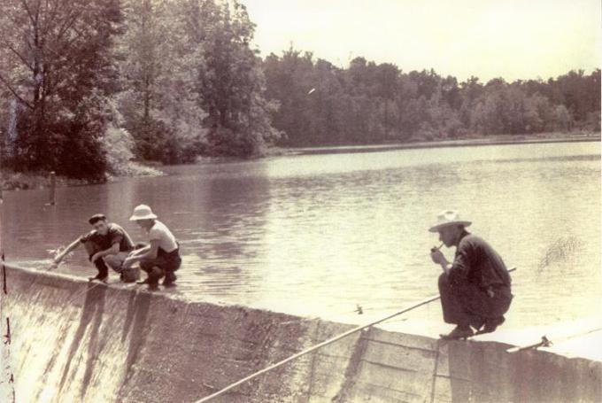
Lake Accotink Park, aside from hosting a vital main stem of our watershed, is also large recreational hub for multiple uses. At its center is the man-made Lake Accotink, established around 1920 with the construction of the dam. The dam has recently undergone reconstruction, calling for the lake to be drained periodically. A day in September when scouting for mussels, and shortly after construction had concluded, the water below the dam was very sediment-heavy, making it difficult to locate the already sparse mussel population.
Secondary single-track unpaved trails a few feet away from the creek walls/lake shore are prevalent throughout. Remnants of bonfire sites along these secondary trails of the creek were noticed along with trash left behind and deposited on the banks from storm surges.
Buffer zone size is ample in most areas considering the typical narrow corridor of protection of watershed in Fairfax County. The quality of vegetative growth, however, leaves something to be desired. Driftwood & debris was found very far away from the creek suggesting that storm surges are helping wash away plant matter & soil.
The elevation, which in some areas rises sharply above 40 feet from the creek banks, is a rare sight along this watershed. Mature trees growing on the side of the steep elevation give the impression that, in some places, the topography is naturally occurring rather than from man made efforts.
Two tributaries, Long Branch from the northwest near Braddock Rd., and Flag Run near the southeast end of Lake Accotink, join the main stem. Several smaller unnamed tributaries also intermittently feed the creek, sourced largely from the runoff of residential and commercial zones. Construction sites near these tributaries are a concern for health of the watershed, as project managers routinely fail to take action to minimize their impact on the environment. For comparative example, FAcC’s YouTube account has several videos highlighting what has been allowed to happen in the case of the 495 HOT lane construction project.
Mussels Eliptio complanata are a strangely anomalous feature in this section. Presumably prolific at one point in Accotink Creek history, they have only been found downstream of the Lake Accotink dam, and only for less than a mile stretch, as of late.
During field research in September 2010, we were encouraged to find a mussel population had survived the sediment onslaught of the dam reconstruction and the HOT Lanes Project . We were also encouraged to find evidence of juvenile mussels, although that evidence was only two smaller empty shells. Typically we are only able to find mature mussels or their empty shells. FAcC members have discovered no other young mussels since monitoring began in 2006. The fish-unfriendly culverts and waterways are prime suspect for inhibiting mussel population growth, although many other variables seem to be acting against these bivalves. Freshwater mussels play a vital role in water filtration and their absence is unsettling when considering the future of Accotink Creek. ( More of Mussels )
Like their invasive plant counterparts, mussels are also sharing space with non-native species. Among them are Corbicula fluminea, or Asiatic clams. They are flourishing, which may indicate that the mussel population could regenerate if the mysterious absence of propagation could be identified and resolved.
Marshland marks the northwest section of the lake where it eventually forms back into the creek for the rest of the section. The vegetative growth in the marsh is strong. Elevation changes begin to flatten out as the creek approaches the Braddock Rd. underpass. Buffer was good in the northern section, and it has only to compete with pervious gravel along the CCT, not exactly ideal but better than impervious asphalt.
Photos at shutterfly.com
