|
I-66 Outside the Beltway
|
|
ALL EYES ON I-66! - UPHOLD ENVIRONMENTAL STANDARDS! Another big project stressing the Accotink Creek watershed, the I-66 Outside the Beltway project crossed 5.1 miles of the Accotink Creek watershed, passing over the tributaries of Long Branch (north), Bear Branch, Hatmark Branch, Hunters Branch, and the headwaters of the northwestern watershed. Construction activity began in late 2017 and accelerated in summer 2018. Although we were unable to hold the asphalt at bay or even to have current stormwater controls applied to this project, we did what we could to hold VDOT and contractors to standards the citizens and environment of Virginia are entitled to expect. Read about our coalition efforts to modify and redirect the project HERE Scroll down to observations from the field along I-66. 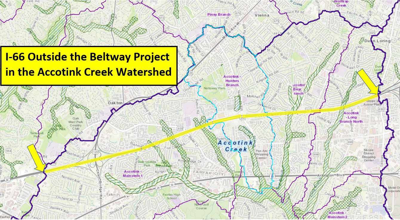
From Jermantown Road to Gallows Road, the project is in the Accotink Creek Watershed
SEE ENVIRONMENTAL VIOLATIONS ON I-66?
You may also advise VDOT of violations at Transform66@VDOT.Virginia.gov , or to your Fairfax County supervisor , or your state legislator Years after completion of the 495 Express Lanes, we struggled to correct erosion control and replanting shortcomings that did not meet minimum standards. We may face a similar situation with the I-66 Express Lanes postconstruction. Read the ongoing sad story of the 495 Express Lanes years after construction - habitat loss, erosion & sedimentation, indifference, and replanting failures. Find project information from VDOT at http://outside.transform66.org The consortium I-66 Express Mobility Partners, owned by Cintra (Spain) and Meridiam Infrastructure (France), has the 50-year concession to build and and operate the project. The construction contractor was FAM Construction, owned by Ferrovial Agroman (Spain - parent company of Cintra) and Allan Myers (Pennsylvania). OBSERVATIONS FROM THE FIELD: December 2023 - The project concludes The I-66 Outside the Beltway project has concluded at last. The murky condition of Accotnk Creek downstream has cleared up with the end of earthmoving. New trees have been planted to replace the acres of woods cut down. Too bad the streams that were buried by the project will not be uncovered ever again. The planted trees are Virginia natives, but not nesessarily native locally, and certainly do not replicate the species that were present before the project cleared them away. 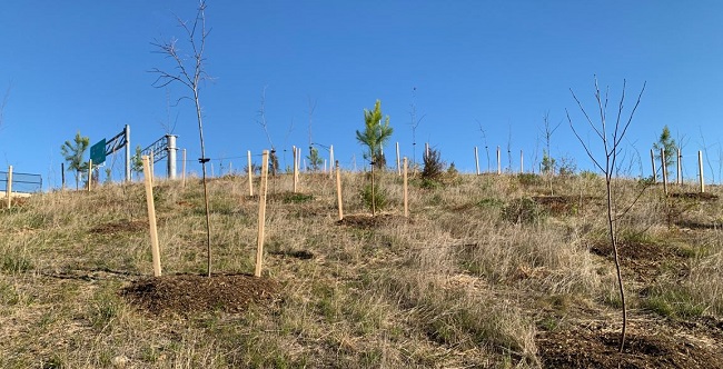
The freshly planted trees in the Chain Bridge Road cloverleaf June 30 & July 7, 2023 - Sediment Discharge: Sediment plume observed far from work zone Two days - one week apart - same sorry situation: Minding our own business, 1.3 miles downstream from the work zone, the I-66 project would not leave us or Accotink Creek in peace. The contrast between the opaque sediment-choked water coming from the construction area and the crystaline flow from other areas compelled a hike upstream to locate the source. It was no surprise to find the trail led to the I-66 project inside the Chain Bridge Road cloverleaf. With no rain for two days, this had to be an intentional discharge. Although there was no opportunity to pinpoint the source, it was worth a report to DEQ. 
Crystal clear water enters from the left, construction soup from the right. May 21, 2023 - Field Survey: Conducted field survey at Chain Bridge Road cloverleaf The project is nearing completion, yet much remains to be done and so many areas have recently been regraded. Many of these areas have been hydroseeded and there is straw spread on other seeded areas. Many other areas are bare soil, some of them graded and seemingly ready for seeding, others in a completely raw condition. Soil storage mounds were generally disappointing, in an unkempt condition. The recentness of the extensive regrading work is perplexing in the several stormwater ponds that seemed to have taken final shape years ago.
The cloverleaf offered little of the charming surprises of native plants managing to hang on in the midst of construction, as often spotted during previous surveys. Perhaps they have been beaten down one time too many. There were some such spots, though, particularly at the cattail-filled stormwater pond in the southwest quadrant, where we spotted a family of Red-winged Blackbirds, a single Tiger Swallowtail, and a bounding Whitetailed deer. A strip of native forest is attempting to regenerate along northbound 123, featuring Elm, Sycamore, Cottonwood, Black Walnut, and Silver Maple, while free of Black Locust. In other areas, Black Locust seems to be able to inexplicably pop up no matter how many times an area is disturbed and deformed. The old soundwalls just east of the cloverleaf have been retained, preserving a "cliff habitat" including native vines such as Virginia Creeper, Wild Grape, and Poison Ivy, but also invasive vines such as Porcelainberry, Oriental Bittersweet, and English Ivy. VDOT's plans for replanting
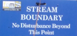
The last brave little water protection sign has fallen. It had held on until now, valiantly guarding a three-yard stretch of a tiny trickle. Even that was too much for the bulldozers to spare. Now the banks are torn up and raw, without the hint of any erosion control measures. The eastern branch of the Mosby Woods tributary within the cloverleaf is now fully entombed in culverts. VDOT gratuitously extended its work outside the soundwall, converting the last bit of open water there into a rock channel. This makes it all the more imperative that the last living segment of this stream on the AT&T property be preserved. Link to photos: July 4, 2021 - Field Survey: Conducted field survey at Chain Bridge Road cloverleaf 
There were slim pickings in the wasteland of the construction zone for the lone Red-shouldered Hawk that circled overhead today, remembering better times when this cloverleaf was a forest. For an environmental control survey, though, it was a target-rich environment. Most of what we documented last time was unchanged, much of what had been repaired had failed, and recent rain opened numerous new erosion gullies. The situation justified filing a report with DEQ. Report Link to photos: June 13, 2021 - Field Survey: Conducted field survey at Chain Bridge Road cloverleaf As well as the usual unstabilized slopes and expanses of bare soil we always find, there are several areas where gullies are forming. Some of these have gone unaddressed since our last survey on May 2nd. Sadder yet was to find that yet more of the eastern branch of the Mosby Woods tributary is being entombed in culverts. Having already taken everything right up to the sound wall, VDOT had to extend its work outside the right-of-way to get at this last bit of open water. Link to photos: June 8, 2021 - Conducted field survey at Prosperity Avenue. Our observations today were in the company of residents of a neighborhood located immediately alongside I-66 and also with a portion of the Long Branch north tributary flowing through. The neighbors related the tale of the woes this community has experienced dealing with a less-than-responsive VDOT over numerous aspects of construction. Construction is nearing its end in the vicinity of Long Branch north, at least so far as the perimeter walls are concerned. While the reconnection of the stream looks good for aquatic wildlife passage, the neighbors have concerns the project has left a pool prone to algae growth and odor at the mouth of the culvert. The neighbors also have doubts about the stability of stones now lining the channel and their likely contribution to increased flooding of the footbridge. Link to photos: May 16, 2021 - Conducted field survey at Nutley Street. Today's survey showed the usual expanses of bare soil and areas that look raw and unkempt. Rather surprisingly, several previously disturbed areas have recovered enough to require mowing (at least until the bulldozers return). One area of particular concern is the utility relocation work that has gone on at a snail's pace for months. This work is apparently not under VDOT supervision and is following decidedly lower standards of erosion and sediment control than the rest of the project. Link to photos: To our surprise, the construction contractor FAM provided a detailed response: May 4, 2021 - Non-penalties for erosion and sediment control failures on I-66 The Virginia Department of Environmental Quality has finalized a Notice of Violation against FAM, the construction consortium handling the I-66 Outside the Beltway project. As usual, the $24,375 penalty is the equivalent of a mosquito bite on a rhinoceros. This rhinoceros has been wallowing in the headwaters of Accotink Creek since 2018, turning the area into a strip of mud, buried streams, and smothering sediment flowing into the tributary streams. These miniscule penalties do not begin to incentivize adherence to the standards that will preserve the health of the waters of Virginia. They will not begin to provide the many millions of dollars the Commonwealth and localities will have to expend in restorative efforts to undo the harm.
May 2, 2021 - Field Survey: Conducted field survey at Chain Bridge Road cloverleaf The race to lay down asphalt continues, with erosion and sediment control measures taking a back seat. The obvious problems we were able to document today included a buried silt fence and developing gullies, as well as the usual unstabilized slopes and expanses of bare soil. Link to photos: March 28, 2021 - Conducted field survey at Nutley Street. We found a mixture of the good and not-so-good in erosion and sediment controls. As usual, there are expanses of bare soil and areas that look raw and unkempt. Several downed silt fences and long-term neglected areas seemed worth a report to DEQ. Report Link to photos: March 7, 2021 - Field Survey: Conducted field survey at Bear Branch tributary. Bear Branch flows through a culvert under I-66. Work on the upstream side seems to have reached final grade. Recently-completed erosion controls appear adequate and fish passage seems decent. On the downstream side, work is still in progress, and there are obstacles to fish passage that need to be addressed. Bare soil is everywhere, as usual on this project. A thick coating of sediment is apparent on downstream rocks. Link to photos: February 28, 2021 - Field Survey: Conducted field survey at Chain Bridge Road cloverleaf The Chain bridge Road overpass has been shifted, so perspectives and viewing points vary somewhat from previous surveys. As usual, while some erosion and sediment controls were in place and effective, expanses of bare soil and unstabilized slopes were on view at every turn. It was raining today, so all erosion control measures were put to the test. Those that failed to measure up included downed silt fences, containment measures that were bypassed by runoff, and an overflowing containment pond. The quantity of sediment flowing downstream from the work zone was evident with a clance at the stream. Unlike most surveys, the upstream quality was not that good, likely due to a new housing development in progress. The situation justified filing a report with DEQ. Report Link to photos: January 17, 2021 - Conducted field surveys at Long Branch north and Nutley Street. Responding to rumors of fish passage improvements, we returned to survey Long Branch north earlier than planned. The news is good, as a clear channel has been opened within the bank-reinforcing rock field to allow fish access to the culvert. There is no drop-off at this culvert, and the water inside is deep, so fish should be readily able to pass under I-66. What they will find in the way of passage on the north side is a mystery since, unlike the fish, we have no ready access to observe that area. Our understanding is that the contractor is obligated to provide fish and aquatic organism passage by the end of the project as part of their Virginia Water Protection Program permit. At Nutley Street, much of the erosion and sediment controls seemed to be in good shape. We still found examples of the usual expanses of bare earth and exposed soil piles, some clearly older than the permitted 14 days. One area of concern was the apparent utility relocation work in the southeast quadrant, where there is little evidence of any stabilization efforts since November 29th and a silt fence had several deficiencies. This seemed worth a report to DEQ. Report Link to photos: December 20, 2020 - Conducted field survey at Prosperity Avenue. Our observations today were mundane. There is little to be impressed with as far as environmental protections are concerned, but also little that is worth reporting. The cumulative effect of this project has left a thick scum of sediment on the streambed of Long Branch. Link to photos: December 13 & 14, 2020 - Field Survey: Conducted field survey at Saintsbury Drive At Saintsbury Drive the situation was fairly appalling. Construction erosion and sediment controls have been neglected long term at this location. Most pressing issues:
The situation was ugly enough to justify filing a report with DEQ. Report Link to photos: November 29, 2020 - Conducted field survey at Nutley Street. Erosion and sediment controls are slipping behind construction in this cloverleaf. Large areas of soil are bare and many soil piles are unconsolidated. Deep tracks in dried mud clearly indicate some of these problems have been left unaddressed through at least one cycle of rain. Precipitation records indicate the last date with more than a trace amount of rain was November 12th, 17 days prior to today. Judging from plans, it is likely this cloverleaf will appear to be utterly transformed by the time the project is completed. Link to photos: November 22, 2020 - Conducted field survey at Chain Bridge Road. Distracted by other events, it has been some weeks since our last survey. The worksite seems not to have changed in any dramatic way since then. The weather has been dry the past week, so there were no immediate issues of runoff or sediment-laden water in streams. The erosion and sediment control issues observed were not as egrigious as some observed in the past. Link to photos: August 16, 2020 - Conducted field survey at Chain Bridge Road. 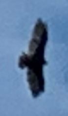
A lone vulture circled overhead today, attracted no doubt, by the stench of death wafting up from the Mosby Woods tributary as it is buried alive. As usual, there was a mix of satisfaction and disappointment in what we observed of the erosion and sediment controls. Our disappointment with the habitat devastation, however, is constant. The expected tropical storm only skirted our area, but the past two weeks saw a bit over 5 inches of rain, as recorded at the nearest weather station. Evidence of new erosion was visible, and water samples downstream from the work zone were cloudy with sediment, but it could have been worse. Link to photos: August 2, 2020 - Conducted field survey at Chain Bridge Road. "The Land That Time Forgot" or so it seems when we observe areas of exposed soil unchanged for week after week, left to erode in the rain. The area generally is unchanged since last week, with many areas of soil left exposed, including most of those that were seen to be eroding last week. An estimated 1/2 inch of rain fell in the past week and water flowing downstream of the work zone was clear. Next week will be a different story, with a tropical storm expected. With just two days before the expected downpours, this area is decidedly not "hurricane ready" - and there is little evidence of any effort to prepare. Link to photos: July 26, 2020 - Conducted field survey at Chain Bridge Road. Several thunderstorms passed through the area during the past week. Rainfall totals in thunderstorms can vary dramatically over short distances - the best approximation is 2 3/4 inches, ending about a day and a half before our survey. Many areas left bare soil exposed and suffered visible erosion. Some locations where stabilization measures had been put in place also suffered erosion. Such failures seem attributable to lack of planning for water flow during rain. Link to photos: July 19, 2020 - Field Survey: Conducted field survey at Vienna Metro, Nutley Street, and Chain Bridge Road. A lack of any appreciable rain for the past few weeks has been an aid to the contractors, allowing all erosion and sediment controls, or their absence, to go untested. At Vienna Metro, the construction zone has largely been tidied up since our last survey on May 17th. Germination is generally acceptable on seeded areas. The Nutley Street cloverleaf has been mostly dormant since trees were cleared a year ago, but activity has now begun to pick up. Stabilization efforts in recently worked spots are largely acceptable. Naturally, yet another area of trees was found that just had to be removed. Major changes in the configuration of the cloverleaf are planned, so there will be much more to monitor here. In the Chain Bridge Road cloverleaf, all the major soil piles are being either diminished or increased, as adjustments are made to accommodate the rapid advance of lane widening on I-66 and realignment of Chain Bridge Road. The work is leaving great areas exposed to rain (when rain returns) but this cannot be labeled a violation unless an area is left exposed and inactive for 14 days. The crypt/culvert that is enclosing the Mosby Woods tributary is steadily advancing. Link to photos: July 5, 2020 - Tour de Tributary - Field surveys of tributaries crossing the I-66 work zone Eight tributaries of Accotink Creek cross I-66. Two were not examined today, Hunters Branch, whose sad fate long ago put it into a tunnel that entirely passes beneath the work zone, and the Mosby Woods tributary, whose mutilation by the current construction is documented in our many surveys of the Chain Bridge Road cloverleaf. The preexisting culverts on the tributaries have for years represented obstacles to fish passage, but fish populations managed at least now and then to make the crossings. The modifications and extensions to the culverts by the project have made no accommodation to better facilitate passage. Further, the fields of large stones newly placed at the ends of culverts seem to constitute even greater impediments to fish passage by turning the main stream channels into mazes of tiny rivulets. Surely, this is a violation of the permits issued by the Corps of Engineers and the Virginia Department of Environmental Quality which state:
☆ Long Branch north - Long Branch was only examined from the downstream side, upstream being entirely in private backyards. The downstream side is currently a messy construction zone, with the stream being mostly pumped around the work area. ☆ Bear Branch - No modifications have yet been made to the downstream side, although that may be expected to change. On the upstream side, the two arms of Bear Branch flow out of the woods of Southside Park directly into a construction zone that clearly treats the stream as a problem, not a treasure. An unusual unidentified substance was contaminating the water downstream from the work zone on Bear Branch. Reports were filed with Fairfax County Fire Department and Virginia Department of Environmental Quality. The Fire Department responded to the scene, investigated, tested the water, and found nothing harmful. The investigator attributed the substance to pollen, but given its appearance and the fact that July is not pollen season, that conclusion seems dubious. ☆ Hatmark Branch - The preexisting culvert extends safely beyond the construction zone on the downstream side, so observations were only made upstream. Construction seems near completion on the western arm of Hatmark Branch. Construction is still underway on the eastern arm, where the area cleared around the stream seems gratuitously large. In both cases, fields of large stones have been put in place that block fish passage. Fish are abundant upstream in the eastern arm, but had not been previously observed in the western arm. The new arrangements seem to guarantee fish will never reach the western arm. ☆ Draper Drive tributary - Most of the planned disturbance of the streambed seems to be over both upstream and downstream. On both sides, fields of large stones constitute daunting obstacles to connection of the upstream and downstream fish populations. Several nearby incidences of cracks in new concrete suggest that cutting corners on this project is not limited to environmental issues. ☆ Ranger Road tributary - The downstream side is very much a work in progress, with the stream mostly pumped around the work zone. Upstream work is farther along, but dubious features such as too-steep slopes adjacent to the stream and unfinished connections from stormwater ponds to the stream are concerning. The few acres of woods that previously surrounded the stream were stripped away in the name of installing the stormwater ponds as an "environmental" enhancement. Another field of large stones is in place on the upstream side, but is submerged, so should not block potential fish movement. ☆ Dale Lestina tributary - Work both upstream and downstream seems nearly complete. On the downstream side another field of large stones impedes fish passage, although there is only a stormwater pond for them to potentially colonize upstream. Link to photos:
June 28, 2020 - Field Survey: Conducted field survey at Rosehaven Street and Chain Bridge Road. At Rosehaven Street, the water being discharged into the Mosby Woods tributary was clear and seems to be groundwater, since there was no pumping and no recent rain. A series of unintended puddles and pools without stabilization is strung along the advancing soundwall. One of them was home to a population of doomed tadpoles. In the Chain Bridge Road cloverleaf, it was the usual mix of stabilization efforts alongside neglected expanses of bare soil. A group of roosting crows summed up the situation:
Desolate yet all undaunted, on this desert land enchanted—
Link to photos: June 21, 2020 - Field Survey: Conducted field surveys at Jermantown Road and Chain Bridge Road. Several thunderstorms occurred over the past few days. At Jermantown Road situation has changed consideribly since our last survey over one year ago. The erosion control situation is much the same as at other spots along I-66, with some pluses and a number of minuses. In the Chain Bridge Road cloverleaf, little change, for better or worse, since the last survey a week ago. Some of the erosion control measures which are new this week seem less than well planned. It is both stirring and sad to see the numbers of native trees resprouting from the roots after being cut down one or more times. Species observed include Persimmon, Sumac, Red Cedar, and more. It seems all are doomed to be cut down yet again. Link to photos: June 14, 2020 - Field Survey: Conducted field survey at Chain Bridge Road. In the Chain Bridge Road cloverleaf, some problems have been addressed, while others have been left without attention. How sad it was to see yet another injury to what few remnants remain of the Mosby Woods tributary. Even more trees have been stripped away and another 50+ yards of the banks have been hacked down to bare soil. Are they adding another crypt to this mausoleum of buried streams? 😢 Link to photos: June 7, 2020 - Field Survey: Conducted field survey at Bear Branch, Saintsbury Drive, and Dale Lestina tributary. Long time, no see. It has been some time since we visited these tributaries downstream from the work zone. Bear Branch flows through a culvert under I-66. At the downstream side, we found the all-too-typical conditions of extensive areas of bare soil without much evidence of stabilization efforts. The stream itself does not seem to have been much affected by construction. At Saintsbury Drive, the situation was similar, with much unstabilized bare soil. All wooded areas existing in the right of way during our last survey on July 24, 2018, have been cleared away. Some areas showed advanced regrowth of volunteer vegetation after clearing. Hatmark Branch passes beneath both I-66 and Saintsbury Drive here, putting the downstream side of the culvert outside the work zone and so far unaffected. At the Dale Lestina tributary, as everywhere, areas of unstabilized bare earth and soil piles are evident. The streambed of the tributary emerging from the culvert has been turned from its former condition of a woodland corridor into a barren field of stones. Link to photos: May 31, 2020 - Field Survey: Conducted field survey at Rosehaven Street and Chain Bridge Road. At Rosehaven Street, the water being discharged into the Mosby Woods tributary today was clear in appearance. Rainfall was minimal during the past week. Further improvements have been made in the stormwater conveyance channel. In the Chain Bridge Road cloverleaf, erosion and sediment controls have mostly been further improved, but with exceptions, including an unstabilized area left untouched since at least April 24th and a location with new gullies forming. Today was a day for flora and fauna - observations included a fox, a Mallard drake, a Red-wing Blackbird, and a trembling fawn by the roadside - all clinging tenuously to the scraps of habitat that have survived. Link to photos: May 18, 2020 - Field Survey: Conducted field survey at Rosehaven Street and Chain Bridge Road. The jury-rigged system for pumping stormwater has been reworked into something much more acceptable. The water being discharged into the Mosby Woods tributary today was clear in appearance. It's not clear why any pumping at all was still needed after several dry days. There was also a troubling scum of thick foam at the mouth of the channel, which likely was of organic origin - we hope. What wonders a Notice of Violation will work! Many of the large soil piles (but not all) that had been left bare for weeks and months have now been stabilized with hydroseeding, giving them a distinctive gray color. Rills and gullies that had already formed on the sides of these piles are still there, posing continued risk for erosion. A conveyance channel had been repaired, and there were areas of seeding with straw. Still, there was no shortage of areas still needing attention and much exposed soil everywhere. It must be noted that no hydroseeding at all can be seen while driving the length of the I-66 project except for this cloverleaf where we have filed reports. It indicates a grudging attitude of minimal compliance. Link to photos: May 17, 2020 - Field Survey: Conducted field survey at Vienna Metro. Much of the area that was bare during our last inspection has had stabilization measures put in place, mostly seeding, but gullies that had formed beforehand are still there, posing continued risk for erosion. A new conveyance channel looks good - but - the steep slope above is is unstable and tumbling down. Link to photos: May 10, 2020 - Field Survey: Conducted field surveys of Chain Bridge Road interchange and Rosehaven Street.
There is not much change at Chain Bridge Road since our last survey. The extensive areas of bare soil and unstabilized soil piles remain. All activity seems to be directed at getting structures into place, while delaying any action at stabilization until final grades are achieved, saving time and money at the expense of Accotink Creek.
The same state of affairs appies to Rosehaven Street, where the new sound wall is advancing. A jury-rigged system for pumping out unintended pools of stormwater continues to send sediment into the western branch of the Mosby Woods tributary. This system is also spilling runoff across the work zone and out onto the roadway.
The vines previously inhabiting the soundwalls along Rosehaven Street , including natives such as wild grape, Trumpet Vine, Virginia Creeper, and Poison Ivy, are all gone. Links to photos: May 8, 2020 - ☆ Notice of Violation: Virginia DEQ cites I-66 contractor ☆ Reponding to our Pollution Reports, Department of Environmental Quality inspectors visited points along the path of construction, found several violations and issued a Notice of Violation to the contractor. The Notice has been referred to the DEQ enforcement section for consideration of appropriate financial civil penalties. We may hope this will focus the contractor's attention and adjust their priorities. A more likely outcome is that the contractor will regard these actions and any penalties as a bothersome "cost of doing business" and continue full speed toward getting their money-making infrastructure in place. Links to documents:
April 24, 2020 - Field Survey: Conducted field survey of Chain Bridge Road interchange. Today's survey was a joint expedition between Potomac Riverkeepers and Friends of Accotink Creek. The entire worksite continues to have a raw and unkempt look, with vast expanses of bare earth and unconsolidated soil piles. Stormwater control features seemed strained and pools of water were evident in places where they did not belong. It now appears that VDOT was not content to put living streams in lifeless culverts. It now seems that the intended route of the pedestrian path will also be in gloomy tunnels. The car is king - all others must bow aside!
Fairfax Connection Article
Link to photos:
April 15, 2020 - Field Survey: Conducted field survey of Chain Bridge Road interchange, Vienna Metro, Prosperity Avenue, and Rosehaven Street. Approximately 2.4 inches of rain fell on April 12th and another one inch on April 13th. Erosion and sediment controls are not put to the test except during rain events, so today's observations were informative. In general everywhere along this project earthmoving seems to have gotten far ahead of soil stabilization efforts. There are large expanses and piles of bare earth everywhere, just waiting to be washed away.
Chain Bridge Road - The Mosby Woods tributary was discolored and opaque with heavy sediment discharge from inside the cloverleaf. Water in the tributary entering the cloverleaf from the upstream side was absolutely clear. From outside the worksite the observer was unable to see what the possible source of sediment might be. However, it could be seen the entire cloverleaf is denuded, with extensive areas of bare earth, great piles of stored unconsolidated soil, and stormwater controls seeming to be in a haphazard state.
Prosperity Avenue - Witnessed sediment being pumped directly into the Long Branch tributary through an inadequate or malfunctioning silt bag or silt barrier. While observing, the entire bag collapsed into the stream, releasing all its load. The tributary was opaque with sediment before and after the collapse. Also, immediately downstream discarded orange safety fencing was in the stream.
Rosehaven Street - A large sediment sandbar has appeared in the tributary, apparently washed down a channel from the active work zone. Silt fence is down adjacent to a bypass pump at the same location. The slope below the bypass pump is also deteriorating, with small gullies beginning to form.
Vienna Metro - How disappointing it was to find the forested area between Saintsbury Drive and the ramp was recently cleared of nearly every scrap of vegetation. The banks of a new stormwater control pond here are raw, lacking soil stabilization, and beginning to gully. This entire worksite seems devoid of soil stabilization beyond “tracking” of slopes
Links to photos:

Mosby Woods tributary runs opaque with sediment from the Chain Bridge Road cloverleaf - from SmugMug April 18, 2020 - Field Survey: Conducted field survey of Sutton Road. Oakton High School, on this block of Sutton Road, was once shielded from I-66 by a buffer of dense woods. Every last tree is gone now. In their place is a raw strip of bare earth next to the foundations of a future concrete soundwall. The expanse of bare earth showed little sign of stabilization and some stormwater controls seemed less than impressive. Link to photos: March 29, 2020 - Field Survey: Conducted field survey of Platten Drive, Bushman Drive, and Appalachian Circle. 
Veil of secrecy or draped in black for the funeral? There is a great deal of unconsolidated exposed earth throughout this zone, indicating haste to maintain a schedule. It was not possible to say how long any areas had been left exposed, but the extensive areas left exposed suggest stabilization measures could not keep up or are being neglected. All exposed earth will cause sediment runoff during rain. There were no other noteworthy instances of erosion and sediment control shortcomings observed (but perhaps that was the purpose of the black fabric screening). Three tributary streams cross the areas surveyed today. All of them are suffering from extension of culverts and loss of wooded buffer due to construction. No fish were observed in the Draper Drive tributary upstream from I-66, but the observation may be inconclusive. The Ranger Road tributary was inaccessible in the construction zone, but had not previously been observed to contain fish. Fish were previously observed in the Dale Lestina tributary, but seem unlikely to have survived the regrading of the stormwater pond there. The number of mature vines inhabiting the soundwalls here before construction was notable, including natives such as wild grape, Trumpet Vine, Virginia Creeper, and Poison Ivy, as well as alien invasives such as Porcelainberry and English Ivy. All are gone now. Links to photos: August 8, 2019 - Field Meeting: Representatives from VDOT, Senator Marsden’s office, Delegate Kaye Kory’s office and Friends of Accotink Creek met to review concerns with the course of the project. The venue of the meeting was a tour of several spots along the project. We received the unfotunate revelation that it is far worse than we thought and most of the tributary within the Chain Bridge Road cloverleaf is to be doomed in the darkess of culverts. More details: 
Riparian Requiem - The group gathers graveside as the Mosby Woods tributary is buried. August 4, 2019 - Field Survey: Conducted field survey of Chain Bridge Road interchange. It now seems clear that the Mosby Woods tributary between Chain Bridge Road and the EB I-66 ramp is to be entirely obliterated and reduced to flowing through a culvert. This is despite protections as waters of the United States, despite clear delineation as a wetland before construction, and despite signage promising protection. This is not at all what VDOT's online plans still indicate - convenient oversight? Much earth has been moved since last time. Many stormwater controls seem to have been forgotten in the rush to pile up soil. There are acres of unconsolidated soil, some of it left exposed for weeks. Link to photos: July 14, 2019 - Field Survey: Conducted field survey of Chain Bridge Road interchange. The Mosby Woods tributary between NB 123 and the ramp from NB 123 to eastbound 66 is still under assault. Heavy equipment is still operation on its banks and in the streambed itself. Great piles of material are encroaching upon the banks. It may be the intended modification is far greater that the online plans would indicate. Little else has changed since our last inspection, just seven days ago, and that is not a good thing. Many drainage and stormwater features have been left in a haphazard state as other work progresses in an apparent rush. Damselflies were frequenting one such spot, where an unintended runoff pond has accumulated, with a single dragonfly perched on a protruding piece of twisted rebar. Some silt fence failures and gullying were evident. What the rush is about is not apparent, as it seems that soil is just being pushed from one spot to another. Link to photos: July 7, 2019 - Field Survey: Conducted field survey of Chain Bridge Road interchange. Shooting the wounded! As a cat toys with a mouse, FAM Construction left us hoping for a half a year that the scant surviving woods in the Chain Bridge Road cloverleaf might be spared. Instead, they now seem to be intent on delivering the coup-de-grâce. The woods left unscathed by the major clearing of last fall have now been scraped to bare earth. This includes the area outside the EB 66 to SB 123 ramp, the sad little sliver that had been clinging to NB Chain Bridge Road just north of 66, and the cruelest "cut" of all, the wooded area within the SB Chain Bridge Road to EB 66 ramp, where the Mosby Woods tributary runs through.
In general, the cloverleaf worksite currently gives the appearance of being in a dash to catch up to schedule or to acheive some goal by a certain date. The state of work has a rushed appearance, with huge areas all being disturbed at the same time and those disturbed areas left unstabilized. Many drainage and stormwater features seem not to have been addressed in the apparent rush. We are unable to say if any of the unstabilized areas have been left that way for over 7 days.
These sad condition were reported to DEQ in hope of enforcement action.
Link to photos: July 5, 2019 - Field Survey: Conducted field survey of Gallows Road overpass. The formerly wooded areas seen during our last inspection on July 23, 2018, are now little more than scrubby regrowth waiting to feel the blade yet again. There is considerable new clearing of trees adjacent to the Dunn Loring Metro parking garage. Although the east side of Gallows Road lies in the Holmes Run watershed, at the northeast corner of the overpass five houses have now been sacrificed and their former location left bare. This is to accommodate widening of the overpass. Link to photos: June 9, 2019 - Field Survey: Conducted field survey at Bushman Drive and Platten Drive. Mighty machines were at work today, devouring the wooded areas along Bushman Drive, right down to the banks of the two tributary streams here. This seems to be more clearing than is needed, but 'Clear first and ask questions later' always seems to be the policy. The VDOT plans do indicate two stormwater control ponds here adjacent to the Ranger Road tributary - of course - install environmental features, but always at the cost of natural habitat and forest. There is nothing on the plans to indicate a motive for clearing near the Dale Lestina tributary at the other end of Bushman Drive. The little woods at Platten Drive have also fallen to the bulldozers, with near zero buffer left on the banks of the stream. Two stormwater ponds appear on the VDOT plan west of Platten Drive, but no similar motive is apparent for the clearing east of Platten Drive. Vines are abundant along the sound walls adjacent to Bushman Drive and Platten Drive. Let's hope some survive this ordeal. Link to photos: June 9, 2019 - Field Survey: Conducted field survey of Nutley Street interchange.
Link to photos: March 27, 2019 - Field Survey: Conducted field survey of Chain Bridge Road interchange. There were no notable observations today. Erosion and sediment controls seemed to be functioning adequately. There are a few small areas that have been neglected for some time, apparently too small to attract the attention of the construction consortium or of DEQ inspectors. It is somewhat heartening that there has been no additional clearing within the cloverleaf for months - dare we hope the remaining woods will be spared? Large scale clearing is certainly still ongoing along other portions of the I-66 project in the Accotink Creek watershed and beyond. Link to photos: January 27, 2019 - Field Survey: Conducted field survey of Chain Bridge Road interchange. The most serious erosion and sediment control failures observed December 16, 2018, have all been corrected, although some smaller issues persist. One troubling finding was a conveyance channel inadvertently filled in. No additional clearing has occured within the cloverleaf. A lone hawk circled forlornly overhead today, perhaps remembering its hunting grounds of last winter, now become a desolate wasteland. Link to photos: January 27, 2019 - Field Survey: Conducted field survey of Jermantown Road crossing. Not a single tree or shrub has been spared along this section. At least the erosion and sediment controls seems to be holding up. Link to photos: January 6, 2019 - Spotted elsewhere along the I-66 Project. 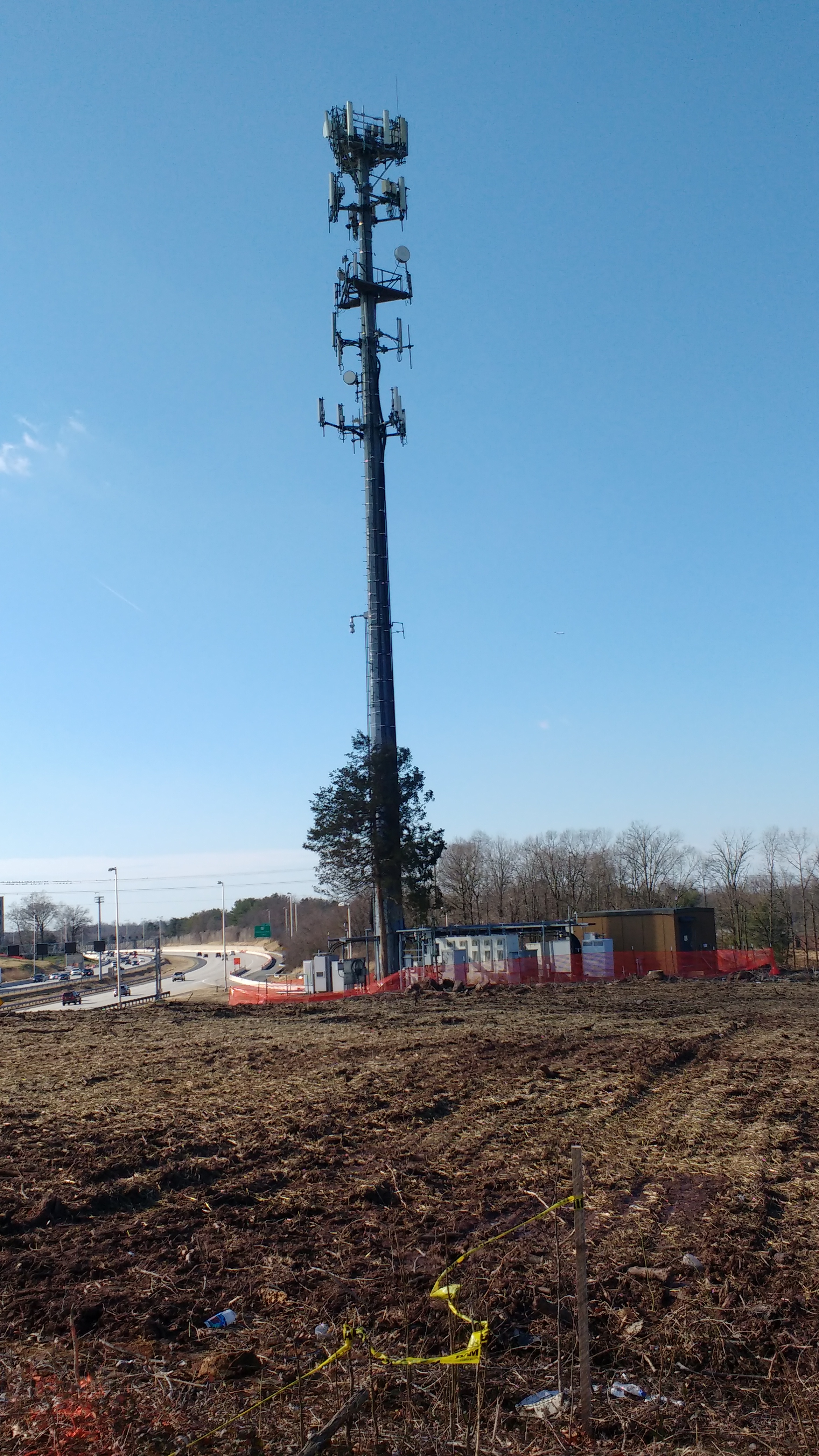
Tree save area? One single solitary tree spared the bulldozer - not for conservation or preservation - but only because it stood next to the inviolable steel tree of a cell tower.
If the cell tower could be spared, why not at least some of the woods around it? Is it just unfortunate force of habit that mandates clearing everything as a matter of course? Could it not just as easily be the standard practice to preserve everything not in the direct path of construction?
December 16, 2018 - Field Survey: Conducted field survey of Chain Bridge Road interchange. In the previous 24 hours, 2.5 inches of rain fell, providing a stress test for sediment and erosion controls. Unfortunately, a number of failures were observed, including several breached silt fences and areas of bare soil left exposed to erosion. Link to photos: December 7, 2018 - Meeting with VDOT & FAM Representatives of Friends of Accotink Creek met with representatives of VDOT and the construction company, FAM. Senator Dave Marsden was also there and Delegate Kaye Kory attended by conference call. We explained the Friends of Accotink Creek concerns with sediment controls and habitat loss, especially the clearance of nearly all vegetative cover down to the banks of the tributary in the 123 cloverleaf. We also reminded VDOT the wetland at Willow Crescent Drive needs to be preserved. Conclusions reached at the meeting were:
December 6, 2018 - Field Survey: Conducted field survey of Nutley Street interchange. Little has changed at this interchange since our last inspection July 24, 2018. Recent mowing (of areas that have always been mowed) took place with large equipment when the ground was wet, leaving large swathes looking raw, rutted, and torn up. There is a previously unnoticed road of sorts into a wooded part of the SE quadrant that has also been left rutted and torn up by recent tractor movement over wet ground. We understand part of the reason for lack of activity here is due to reevaluation of the design of the future interchange. Link to photos: November 18, 2018 - Field Survey: Conducted field survey of streams in Chain Bridge Road interchange. Most of banks of the two branches of the Mosby Woods tributary that flow through the cloverleaf now have been cleared nearly to the banks or all the way to the banks. This level of clearing seems excessive and gratuitous and has been done in spite of the tidy little signs put in place to mark protected wetlands. Closer examination is disappointing, with many areas where erosion and sediment controls along the banks seem inadequate or even haphazard. Fish populations are still present in these tributaries, but the abundance seen before construction was not observed during this inspection. The loss of the shade and food source provided by streamside trees will surely harm fish populations. Our requests to speak with VDOT or FAM Construction staff regarding stream protection here have still not been fulfilled. Link to photos: November 9, 2018 - Field Survey: Conducted field survey of Chain Bridge Road interchange. Clearing of wooded areas within the cloverleaf has advanced since our September 7, 2018, survey. Parts of the two branches of the Mosby Woods tributary that flow through the cloverleaf now have been cleared nearly to the banks. This does not portend well for the future of the fish populations in these tributaries, which were surprisingly abundant, even within the cloverleaf, before construction. Our requests to speak with VDOT or FAM Construction staff regarding stream protection here have still not been fulfilled. Erosion and sediment controls in general continue to be adequate and holding up. Some of the areas most recently cleared, however, were looking quite raw and neglected. We may hope this will be quickly remedied. Link to photos: September 7, 2018 - Field Survey: Conducted field survey of Chain Bridge Road interchange. Most of the interior of the Chain Bridge Road cloverleaf was formerly thickly wooded, but this has changed dramatically since our June 18, 2018, survey. Much of the cloverleaf is now denuded, although wooded areas do remain. We may hope that the wooded areas have been set aside as protection for the two branches of the Mosby Woods tributary that flow through the cloverleaf. Our requests to speak with VDOT or FAM Construction staff regarding stream protection here have gone unanswered for weeks. Erosion and sediment controls seem so far to be adequate and holding up in spite of frequent rainstorms. The rain has had the benefit of promoting germination of stabilizing grasses. We were encouraged to see at least one sign warning against wetland disturbance - and hope there are many more we have not yet observed. Link to photos: September 6, 2018 - Field Survey: Conducted field surveys of two points that afford public access for observations of I-66. There is not much activity to observe at these points. Observation is possible only outside the soundwall. It may be that these spots will be unaffected by construction. The headwaters of the Mosby Woods tributary pass under Rosehaven Street and enter the Chain Bridge Road cloverleaf here. The number of mature vines inhabiting the soundwalls here is notable, including natives such as wild grape, Trumpet Vine, Virginia Creeper, and Poison Ivy,as well as alien invasives such as Porcelainberry and English Ivy. Links to photos of access points observed: August 30, 2018 - Field Survey: Conducted field surveys of two points that afford public access for observations of I-66. Serious construction has not reached these points yet, other than some initial clearing for later equipment access. No erosion and sediment control issues were evident. Three tributary streams pass beneath I-66 in these areas, so they will be areas especially vulnerable to damage during construction. The number of mature vines inhabiting the soundwalls here is notable, including natives such as wild grape, Trumpet Vine, Virginia Creeper, and Poison Ivy,as well as alien invasives such as Porcelainberry and English Ivy. Links to photos of access points observed: August 16, 2018 - Field Survey: Conducted field surveys of three points that afford public access for observations of I-66. Little has changed at these points since the initial clearing of acess paths. Nothing unexpected or noteworthy was observed as far as erosion and sediment controls. Links to photos of access points observed: July 23, 24, & 27, 2018 - Field Survey: Conducted field surveys of several points that afford public access for observations of I-66. Tree clearing is well underway at the Jermantown Road overpass and western end of I-66 in the Accotink Creek watershed. Farther east, less clearing is visible. Although there were heavy rains the previous few days, no egregious erosion and sediment control failures were evident, although there were some problems at the Saintsbury Drive location. One discovery was a small wetland adjacent to Willow Cresent Drive. Although it is untouched so far, it has no protective signage. We may hope it has been recognized and will be avoided. Links to photos of access points observed:
June 18, 2018 - Field Survay: Conducted field survey of Chain Bridge Road interchange. Most of the interior of the Chain Bridge Road cloverleaf is thickly wooded, although heavily infested by invasive alien species. One area in the northeast of the cloverleaf has long been used as an equipment staging area. Tree clearing has begun, particularly in the northeast quadrant. Link to photos: 
June & July, 2018:
Surveyed the tributaries that cross I-66 in anticipation of the I-66 Date: April 3, 2015, Survey Photos Members of Friends of Accotink Creek made a quick survey of wooded habitat along the I-66 right-of-way likely to be reduced or lost in any widening. As might be expected, the quality of habitat was largely disappointing, with large numbers of invasive alien plants occupying only a narrow wooded buffer. Larger patches of better quality habitat are in the cloverleafs at Nutley street and Chain Bridge Road, in Southside Park in Vienna, and in the common property of the Four Winds community in Oakton. Degraded as it may be, even such small habitat areas have value that should be preserved. Also found during the survey was evidence of erosion and sediment control failures that we may expect on a large scale from any project that goes forward along I-66. Friends of Accotink Creek documented many such failures during construction of the 495 Express Lanes. This time what we found was small, but flagrant - bare slopes left to erode, silt fences collapsed, and quantities of sediment in waterways. Our Reports to VDOT and DEQ seem to have gone the way such reports are usually handled. Typically in these cases, if any action is taken, the responsible party is merely told to begin doing what they should have done all along - no fine is levied and no remediation of damage is required.
|
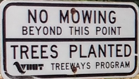 Our hopes for the sad little woods of the Nutley Street cloverleaf have been dashed. The cloverleaf has now been cleared edge-to-edge, with not a single tree left. A forlorn "No Mowing" sign now stands guard over a stark wasteland. Much of the cleared area has been left too long without reseeding, making the bare soil more suseptible to erosion. There is still some hope that the annually mown areas, some of which have pretty good stands of wildflowers, may yet survive.