|
George Snyder Trail -
|
|
♫ Everything is awesome when you're part of the plan! ♫ * Can't get enough pavement in our parks, floodplains and stream valleys? Then here's a "plan" for much more! February 5, 2025: ALERT: What a difference an election makes - A new City Council majority seems to see the question of asphalt vs. forest in a new light that favors preservation over paving. The George Snyder Trail is a discussion item on the March 11, 2025, Council agenda. Now is the time to email the Councilmembers to let them know we support them in their defense of our woods and watersheds. More Details and Emails Please also consider speaking about the George Snyder Trail and connector trails during the public comment periods at the February 11th and 25th regular Council meetings. Please also show up at the March 11th Council meeting to show your support. January 14, 2025:
January 23, 2024: It's not over until the bulldozers roll, but the news from City Council today was discouraging. A majority of the Councilmembers agreed the George Snyder Trail extension should be modified and reduced. However, lacking a majority for any specific modification resolution, inertia carried the day. The result? The project will grind forward, bringing its black scar of tar to bisect Fairfax City's dwindling forests. Video of City Council Debate and Votes 2024 is an election year for Mayor and City Council. Look for upcoming candidate information on the City Website and the Virginia Public Access Project. Let the candidates know we need to make our streets safe for people before we make our forests safe for pavement. Victory may yet spring from the jaws of destruction. Friends of Accotink Creek belatedly became aware of proposals to extend the George Snyder Trail, promoted as a fulfillment of a long-standing Trails Plan. 
Other City plans need to be fulfilled, too, such as the Comprehensive Plan Environment and Sustainability Chapter, the Chesapeake Bay Preservation Plan, and the Northfax Small Area Plan. All these plans sanguinely assure the preservation of trees and streams while other City, Commonwealth, and private interests continue to clear them away. Why should the environmental preservation mandates of these other plans not take priority?
Let the Mayor and City Council know how you feel about preservation vs. pavement at:

The dashed line of doom Friends of Accotink Creek Three Last Alternatives Fairfax Now articles Jan. 11, 2024 - January 26, 2024 Fairfax City Patch article Jan. 8, 2024 Fairfax Times article Dec. 22, 2023 Fox 5 News reports Dec. 6, 2023 - January 25, 2024 Stand with the Trees! appeal from Fairfax City Environmental forum Fairfax City Patch article Oct. 23, 2023 Audubon Society of Northern Virginia analysis of the alarming scale of land clearing Citizens provide testimony at City Council September 26, 2023 Facebook video Connection article covering City Council discussion July 18, 2023 Citizens present Fairfax City Council a petition of 865 signatures (now 2300 and growing) favoring the protection of forests from paving PETITION - VIDEO Comments from Friends of Accotink Creek, January 2022 Comments from Friends of Accotink Creek, October 2020 Joint Letter from conservation groups Letter from neighbors Letter from Northern Virginia Audubon Society Letter from Fairfax Tree Stewards Story map of an alternate route along the wastewater line City of Fairfax George Snyder Trail website George Snyder Trail 30% plan Notes of a survey hike along the proposed route Proposed route property ownership maps Other reports on problematic trail paving: Pickett Road Connector - Lake Accotink Park - Pine Ridge Park - John Mason Trail
George Snyder Trail Information Flyer
| ||
|
|
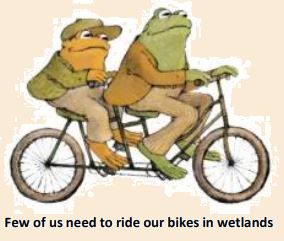 Improved opportunities for bicycle and pedestrian travel are welcome, but the proposed route of the extension means this opportunity would come at the expense of forests and streams. We have plenty of streets that need to be made people-friendly first!
The comments submitted by Friends of Accotink Creek to the Mayor and City Council, below, are a statement of the principles we hope to see applied whenever we are faced with the temptation to take “just one more bite”, to lay just one more burden on our irreplaceable natural heritage.
Improved opportunities for bicycle and pedestrian travel are welcome, but the proposed route of the extension means this opportunity would come at the expense of forests and streams. We have plenty of streets that need to be made people-friendly first!
The comments submitted by Friends of Accotink Creek to the Mayor and City Council, below, are a statement of the principles we hope to see applied whenever we are faced with the temptation to take “just one more bite”, to lay just one more burden on our irreplaceable natural heritage.