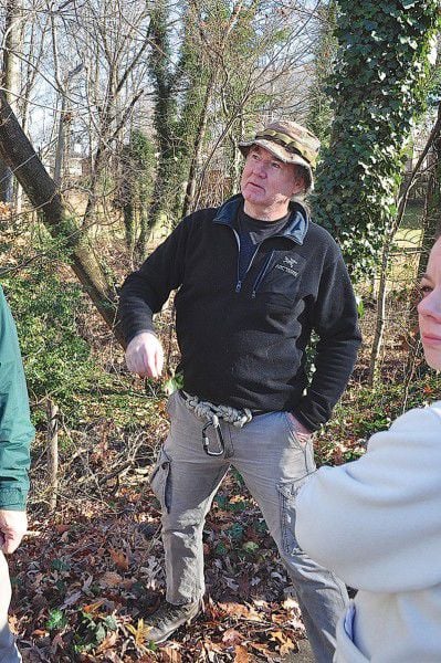

Don Pless is a self-proclaimed documents guy. A retired auditor from the U.S. Government Accountability Office, Pless, 65, has redirected his verve and passion for accountability to improving an urban stream in his backyard.
“Transparency, accountability, accuracy, integrity — as long as you guys like those goals, then we should get along fine,” Pless said to a half-dozen public officials who joined him for a walking tour of Flag Run in mid-December.
After deluging them for weeks with e-mails and regulatory questions about the stream, Pless invited them outside to see firsthand the waterway he walks with his German shepherd, Volt, almost everyday. He wanted them to see the ponds where he’s seen tadpoles in the spring and the stream where an occasional perch swims and then “decide whether it’s worth saving or not.”
Flag Run is located within Lake Accotink Park and the broader Accotink Creek watershed, a 51-square-mile swath in the center of Fairfax County, VA, that eventually drains into the Potomac River.
An aerial view of the stream, which originates near Interstate 495 and flows into the man-made Lake Accotink, shows what’s working against it. Cul-de-sacs snake across the landscape on both sides of the stream, a pattern that’s interrupted only by an industrial park and a spattering of green spaces.
The stream benefits from forested buffers along its length that expand into the wooded portion of Lake Accotink Park, but the strips of trees are not wide enough to filter polluted runoff and high water flows from the pavement surrounding them. Almost 30 percent of the watershed is impervious surfaces, and the number is expected to rise to 35 percent, according to the county’s Stream Protection Strategy.
When it comes to water quality and life, Flag Run is among the worst of the streams in the watershed.
“I should think that makes it more of a priority,” said Philip Latasa, founder of the Friends of Accotink Creek, who joined the walking tour. “It’s not beyond salvation. We’re not ready to throw up our hands and put in a concrete ditch.”
Beyond caring for the waterway in his backyard, Pless sees Flag Run as a microcosm of the rest of the Chesapeake Bay watershed, one that could serve as a demonstration project.
“You can almost get all the same issues here in this little piece of geography as in the entire metropolitan watershed,” Pless said over the phone before the tour. “The only thing we don’t have here is a lot of chickens.”
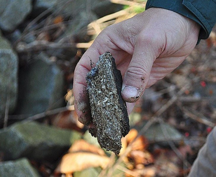
Despite all that’s working against the urban stream, Pless said he’s found evidence of native ecosystems — and of “benthic life” on the stream’s bottom — worth saving. He didn’t think the county was working fast enough to address the problems working against them, so he started e-mailing.
Pless isn’t the first one to suggest improvements for the watershed.
The EPA established a total maximum daily load for Accotink Creek in 2011 that aimed to reduce the amount of sediment flowing into the creek by 50 percent. The measure would have required homeowners, business owners and local governments to retrofit their mostly midcentury properties to capture all of their stormwater. The cost of compliance would have been substantial.
The Virginia Department of Transportation and the Fairfax County Board of Supervisors sued the EPA in federal court, challenging the methodology, which used water as a stand-in for sediment to set the pollution limits.
A federal judge ruled in early 2013 that the EPA could not use flow to measure a pollutant — in this case, sediment.
It was estimated in 1986 that every day Accotink Creek carries a volume of sediment equal in size to a metro bus into Lake Accotink, mostly the result of high flows of water coming off of impervious surfaces — including six major commuter roads that run through the watershed. That landscape hasn’t changed much since then.
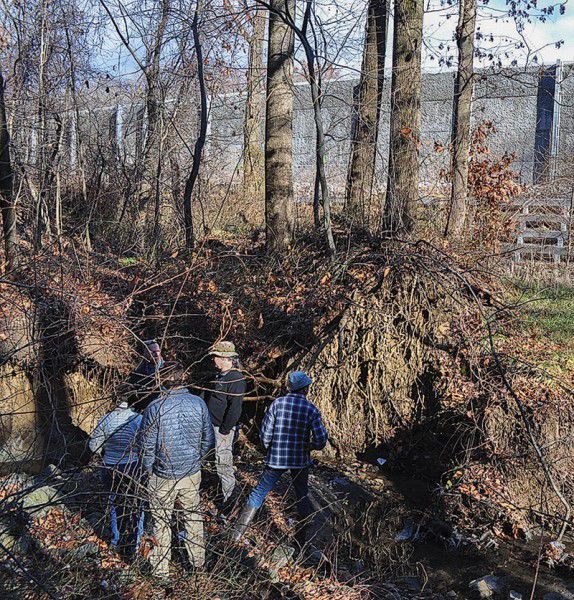
During the walk along Flag Run, some lower portions of the stream bank appeared to have stabilized after years of rapidly moving water had reshaped them. This is where Pless said he’s seen frogs and fish, but only in small sections of the stream.
Charles Smith, a project manager with Fairfax County’s Stormwater Planning Division who took the tour, said doing a restoration project that involved wheeling heavy equipment into the area would likely do more harm than good in this portion of the stream.
But other parts of Flag Run still showed the symptoms of a heavily developed watershed and, Smith said, room for improvement.
Along the way, Pless pointed out pet projects he’d like the county or the local park authority to consider. He’d like the park to look more like Huntley Meadows Park in Alexandria, the second-largest park in Fairfax County and one that’s prized for its wetland habitat.
He’d like the master planning process for the park, now under way, to include an environmental assessment of the benthic life in the stream and a document that requires new construction projects to guarantee “no net loss of habitat.”
“What he’s saying is to take a conservation approach to planning and development for the park,” said Sandra Stallman, manager of the parks planning branch of the Fairfax County Park Authority, during the tour. “That’s something we would do, we will do and we are doing.”
Stallman said she often tours the parks under her purview with citizens who are concerned about them, and they all seem to have a different priority. “We have a very active citizenry,” she said.
“This is a normal part of the process,” Smith said. “The thing about county government is we are directly responsible to the citizens.”
The park authority owns the land directly surrounding the stream, so Pless and others have made the argument that they could do more to improve its health.
But the main factors working against the stream — a watershed full of residences and businesses built before modern stormwater controls were required — are outside the control of the park or the current county government, Smith said.
“When you don’t control the land in the watershed, it’s hard to fix [conditions] in the streams,” he said.
He added that any redevelopment in the area is likely to reduce the high water flows, because “as soon as they put in an application to do something on that property that disturbs land, they’re going to have to change how they manage water.”
Pless would like the officials to be more proactive. Along the way, he pointed out a vacant lot for sale in an otherwise developed neighborhood near one entrance to the park’s trail and the Shenandoah’s Pride Dairy facility that’s for sale near the headwaters of Flag Run.
“Why don’t you just buy it?” he asked.
“There’s not funding, and we can effect the same change through redevelopment,” Stallman replied.
The group was standing in a narrow strip of woods surrounding Flag Run that’s part of a stream valley park. This type of narrow, streamside park that often links up with other parks basically “protects the stream valleys from becoming culverts,” said John Stokely, a natural resources branch manager with the park authority.
Andy Galusha, a park planner with the park authority, added that some of Fairfax County’s oldest parks are of the stream valley variety. They “provide wildlife corridors and trails…even though they are impacted by all of this development pressure,” Gelusha said, gesturing to backyard fences a stone’s throw from the stream.
From this vantage point near Queensbury Road, the stream was sandwiched between houses on one side and an industrial park on the other. Ahead loomed the tall concrete wall that lines 495 and bisects Flag Run.
The stream’s condition looked less stable as the group neared the highway. There were more invasive plant species; there was more trash.
Near the outfall that feeds the stream from the industrial parking lot, the difference between the stream’s highest flows and its current trickling pace became apparent. It wasn’t hard to imagine water gushing in through the outfall during a sudden rain, cutting the soil out from under tall trees whose roots now lay bare on the stream bank.
“The stream is cutting out from the banks and producing a lot of sediments,” Smith said. “The channel is trying to widen itself, because the banks are too steep…a lot of times, stream restoration takes it to that point.”
After the tour, Smith wrote up his observations about the stream and later returned with a colleague to take a closer look. They scored Flag Run for potential restoration projects, something they would have done eventually, “but [Pless] did accelerate the process.”
“It is a stream that was known, but there are so many bad ones in the Accotink that we hadn’t gone to score that one yet,” he said in late January.
His colleague e-mailed Pless that month to tell him that, while the projects for this fiscal year were already set, Flag Run “seems to have a good restoration potential and should be on the short list of potential projects for fiscal year 2017.”
Pless asked for a copy of the work plan. He wants to know how they decide what gets funded when.
“When the scientists say, ‘I can’t restore life in this stream,’ I’ll give up,” Pless said. “I’ll move on.”
(0) comments
Welcome to the discussion.
Log In
We aim to provide a forum for fair and open dialogue.
Please use language that is accurate and respectful.
Comments may not include:
* Insults, verbal attacks or degrading statements
* Explicit or vulgar language
* Information that violates a person's right to privacy
* Advertising or solicitations
* Misrepresentation of your identity or affiliation
* Incorrect, fraudulent or misleading content
* Spam or comments that do not pertain to the posted article
We reserve the right to edit or decline comments that do follow these guidelines.